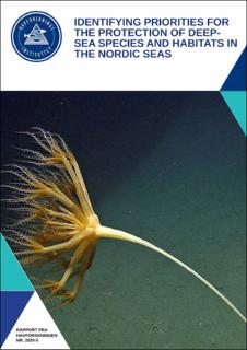
Identifying priorities for the protection of deep-sea species and habitats in the Nordic Seas
Research report
Published version
Permanent lenke
https://hdl.handle.net/11250/3122403Utgivelsesdato
2024Metadata
Vis full innførselSamlinger
Sammendrag
Marine Protected Areas (MPAs) are recognized as a key instrument to reverse global biodiversity loss and for Norway to meet its commitment to conserve 30% of its marine area by 2030, based on targets established within the Convention of Biological Diversity (CBD) and the recently ratified COP15 Kunming-Montreal Global Biodiversity Framework1. Specifically, MPA network criteria advanced by the CBD1,2 entail protection of at least 30% of all habitats and marine landscapes occurring in a given study area, as well as 100% protection of all important habitats in the same area. In pursuit of these targets, we have conducted spatial analyses to elucidate, based on the current knowledge, the optimal MPA network design ensuring both maximal biodiversity protection and the continued provisioning of deep-sea benthic ecosystem services in the Nordic Seas. The scope of the analyses included geological and ecological data available for the study area (from the upper part of shelf beak down to the deepest abyssal plains) comprising information on 1) seabed topography, geomorphic characteristics and marine landscapes, 2) the distribution, abundance and diversity of species and 3) the distribution of vulnerable and important ecosystems. Due to the limited knowledge of species occurrences in the area, this analysis heavily relies on topography, geomorphology, and sea-scape classifications, which are known to be strongly correlated with species distributions. Three different MPA network scenarios were generated with a protection target of 30% of the study area. In addition, scenarios representing 40% and 50% protection were produced, based on empirical evidence that this is the minimum size needed to fully protect the range of different aspects of biodiversity components, as well as threatened species. Several scenarios of buffer zones were also proposed to shield the core MPA units from effluents from human activities in the surrounding areas that may drift into the units with water currents. From these scenarios, we described in more detail one of the 30% protection MPA network scenarios that meets the COP15 30x30 protection targets in the best possible way. This network covers 407 968 km², representing 33% of the study area in total, and is composed of 22 MPA units ranging from 85 to 77 242 km². It protects 100% of all known active and inactive hydrothermal vents and cold seeps, as well as 100% of the areas defined as coral and sponge hotspots. Spatially, it protects between 30-39% of all occurring marine landscape types (as defined by the Geological Survey of Norway). We expect that this knowledge review and the spatial analysis presented will serve as a meaningful contribution to the discussion on how Norway should approach meeting its COP15 30x30 conservation commitments. Timely discussion of the conservation and protection needs of deep-sea ecosystems of the Nordic Seas would significantly strengthen Norway’s reputation as a nation driving both the development and the implementation of knowledge-based management of marine resources and ecosystems. Identifying priorities for the protection of deep-sea species and habitats in the Nordic Seas