| dc.contributor.author | de Jong, Karen | |
| dc.contributor.author | McQueen, Kate | |
| dc.contributor.author | Hareide, Nils Roar | |
| dc.contributor.author | Tenningen, Maria | |
| dc.contributor.author | Macaulay, Gavin | |
| dc.contributor.author | Majaneva, Markus | |
| dc.date.accessioned | 2023-03-07T09:00:04Z | |
| dc.date.available | 2023-03-07T09:00:04Z | |
| dc.date.created | 2023-03-06T10:09:21Z | |
| dc.date.issued | 2023 | |
| dc.identifier.uri | https://hdl.handle.net/11250/3056251 | |
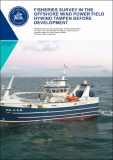
| dc.description.abstract | The purpose of the cruise was to carry out a fish capture experiment in the area where a floating windfarm will be built to supply the oil and gas installations with renewable energy. The windfarm is located on the south side of the fishing ground Tampenbanken on the slope down to the Norwegian Trench, (See map figure 1). The windfarm is located at depths between 290 and 300 meters. The wind turbines planned in the park will be floating and must be anchored to the bottom with suction anchors. The windfarm will supply electricity to the oil platforms at Gullfaks and Snorre (Equinor 2019). | |
| dc.description.abstract | Fisheries survey in the offshore wind power field Hywind Tampen before development | |
| dc.language.iso | eng | en_US |
| dc.publisher | Havforskningsinstituttet | en_US |
| dc.relation.ispartof | Toktrapport | |
| dc.relation.ispartofseries | Toktrapport;2022 - 15 | |
| dc.relation.uri | https://www.hi.no/hi/nettrapporter/toktrapport-en-2022-15 | |
| dc.title | Fisheries survey in the offshore wind power field Hywind Tampen before development | en_US |
| dc.title.alternative | Fisheries survey in the offshore wind power field Hywind Tampen before development | en_US |
| dc.type | Research report | en_US |
| dc.description.version | publishedVersion | |
| dc.source.pagenumber | 36 | en_US |
| dc.source.issue | 2022 - 15 | en_US |
| dc.identifier.cristin | 2131420 | |
| dc.relation.project | Havforskningsinstituttet: 15864 | |
| cristin.ispublished | true | |
| cristin.fulltext | original | |
