| dc.contributor.author | Gonzalez-Mirelis, Genoveva | |
| dc.date.accessioned | 2023-03-06T12:37:59Z | |
| dc.date.available | 2023-03-06T12:37:59Z | |
| dc.date.created | 2023-02-20T13:35:52Z | |
| dc.date.issued | 2022 | |
| dc.identifier.uri | https://hdl.handle.net/11250/3056055 | |
| dc.description.abstract | MAREANO is an interdisciplinary program carried out as a collaboration between the Mapping Authority ( Kartverket ), the Geological Survey of Norway (NGU, in Norwegian) and the Norwegian Institute of Marine Research (IMR). The Program implementation is led by the Program Group, with representatives from five directorates and the three above-mentioned executive institutions, while a Steering Group (Ministry of Industry and Fisheries, Oil and Energy, Climate and the Environment, Transport and Municipalities and Modernisation) determines the mandate of the Program. The MAREANO Program started in 2005 with the first survey conducted in 2006. | |
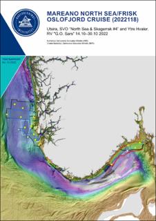
| dc.description.abstract | MAREANO North Sea/Frisk Oslofjord cruise (2022118) — Utsira, SVO “North Sea & Skagerrak #4” and Ytre Hvaler. RV "G.O. Sars" 14.10–30.10 2022 | |
| dc.language.iso | eng | en_US |
| dc.publisher | Havforskningsinstituttet | en_US |
| dc.relation.ispartof | Toktrapport | |
| dc.relation.ispartofseries | Toktrapport;2022 - 13 | |
| dc.relation.uri | https://www.hi.no/hi/nettrapporter/toktrapport-en-2022-13 | |
| dc.title | MAREANO North Sea/Frisk Oslofjord cruise (2022118) — Utsira, SVO “North Sea & Skagerrak #4” and Ytre Hvaler. RV "G.O. Sars" 14.10–30.10 2022 | en_US |
| dc.title.alternative | MAREANO North Sea/Frisk Oslofjord cruise (2022118) — Utsira, SVO “North Sea & Skagerrak #4” and Ytre Hvaler. RV "G.O. Sars" 14.10–30.10 2022 | en_US |
| dc.type | Research report | en_US |
| dc.description.version | publishedVersion | |
| dc.source.pagenumber | 28 | en_US |
| dc.source.issue | 2022 - 13 | en_US |
| dc.identifier.cristin | 2127577 | |
| dc.relation.project | Havforskningsinstituttet: 15312 | |
| dc.relation.project | Havforskningsinstituttet: 15760 | |
| cristin.ispublished | true | |
| cristin.fulltext | original | |
