| dc.contributor.author | Bouleau, Mireille | |
| dc.contributor.author | Bez, Nicholas | |
| dc.contributor.author | Reid, David | |
| dc.contributor.author | Godø, Olav Rune | |
| dc.contributor.author | Gerritsen, Hans D. | |
| dc.date.accessioned | 2012-11-20T20:20:18Z | |
| dc.date.available | 2012-11-20T20:20:18Z | |
| dc.date.issued | 2004 | |
| dc.identifier.citation | This report is not to be cited without prior reference to the authors | no_NO |
| dc.identifier.uri | http://hdl.handle.net/11250/106429 | |
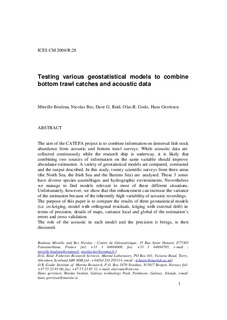
| dc.description.abstract | The aim of the CATEFA project is to combine information on demersal fish stock
abundance from acoustic and bottom trawl surveys. While acoustic data are
collected continuously while the research ship is underway, it is likely that
combining two sources of information on the same variable should improve
abundance estimation. A variety of geostatistical models are compared, contrasted
and the output described. In this study, twenty scientific surveys from three areas
(the North Sea, the Irish Sea and the Barents Sea) are analysed. These 3 zones
have diverse species assemblages and hydrographic environments. Nevertheless
we manage to find models relevant to most of these different situations.
Unfortunately, however, we show that this enhancement can increase the variance
of the estimation because of the inherently high variability of acoustic recordings.
The purpose of this paper is to compare the results of three geostatistical models
(i.e. co-kriging, model with orthogonal residuals, kriging with external drift) in
terms of precision, details of maps, variance local and global of the estimation’s
errors and cross validation.
The role of the acoustic in each model and the precision it brings, is then
discussed. | no_NO |
| dc.language.iso | eng | no_NO |
| dc.publisher | ICES | no_NO |
| dc.relation.ispartofseries | ICES CM Documents;2004/R:28 | |
| dc.subject | demersal fish | no_NO |
| dc.subject | bunnfisk | no_NO |
| dc.subject | bottom trawl | no_NO |
| dc.subject | bunntrål | no_NO |
| dc.subject | acoustics | no_NO |
| dc.subject | akustikk | no_NO |
| dc.subject | stock assessment | no_NO |
| dc.subject | bestandsberegning | no_NO |
| dc.title | Testing various geostatistical models to combine bottom trawl catches and acoustic data | no_NO |
| dc.type | Working paper | no_NO |
| dc.subject.nsi | VDP::Agriculture and fishery disciplines: 900::Fisheries science: 920::Catch: 925 | no_NO |
| dc.subject.nsi | VDP::Mathematics and natural science: 400::Geosciences: 450::Oceanography: 452 | no_NO |
| dc.subject.nsi | VDP::Social science: 200::Library and information science: 320::Knowledge retrieval and organization: 323 | no_NO |
| dc.source.pagenumber | 19 s. | no_NO |
